Although the answers to the questions 1) "what is a mountain?" and 2) "where are the mountains of the world?" might seem obvious and intuitive to many, there have been surprisingly few attempts to rigorously and consistently define and map the mountains of the Earth. Two geographic information systems (GIS)-based characterizations derived from global digital elevation models (DEMs) at a spatial resolution of approximately 1 km have considerably advanced our understanding of the global distribution of mountains.
K1 refers to the characterization of Kapos et al. (2000), and represents a resource produced by the UNEP World Conservation Monitoring Center (WCMC). K2 refers to the characterization of Koerner et al. (2011), and is associated with the Global Mountain Biodiversity Assessment (GMBA). K3, meanwhile, refers to the characterization by Karagulle et al. (2017), and was developed by Esri and the U.S. Geological Survey. The GME is a map-centric tool which allows users to query any location on Earth and identify whether or not it is mountainous according to the three delineations. The map viewer has a wide range of functionality, including pan and zoom, making location queries split-screen pairwise comparisons, conducting text searches on place names, and displaying of the mountain areas over a variety of basemaps including satellite imagery and topographic maps. Further information on K1, K2, and K3, as well as the GME 1.0, is provided in a paper in Mountain Research and Development by Sayre et al. (2018).
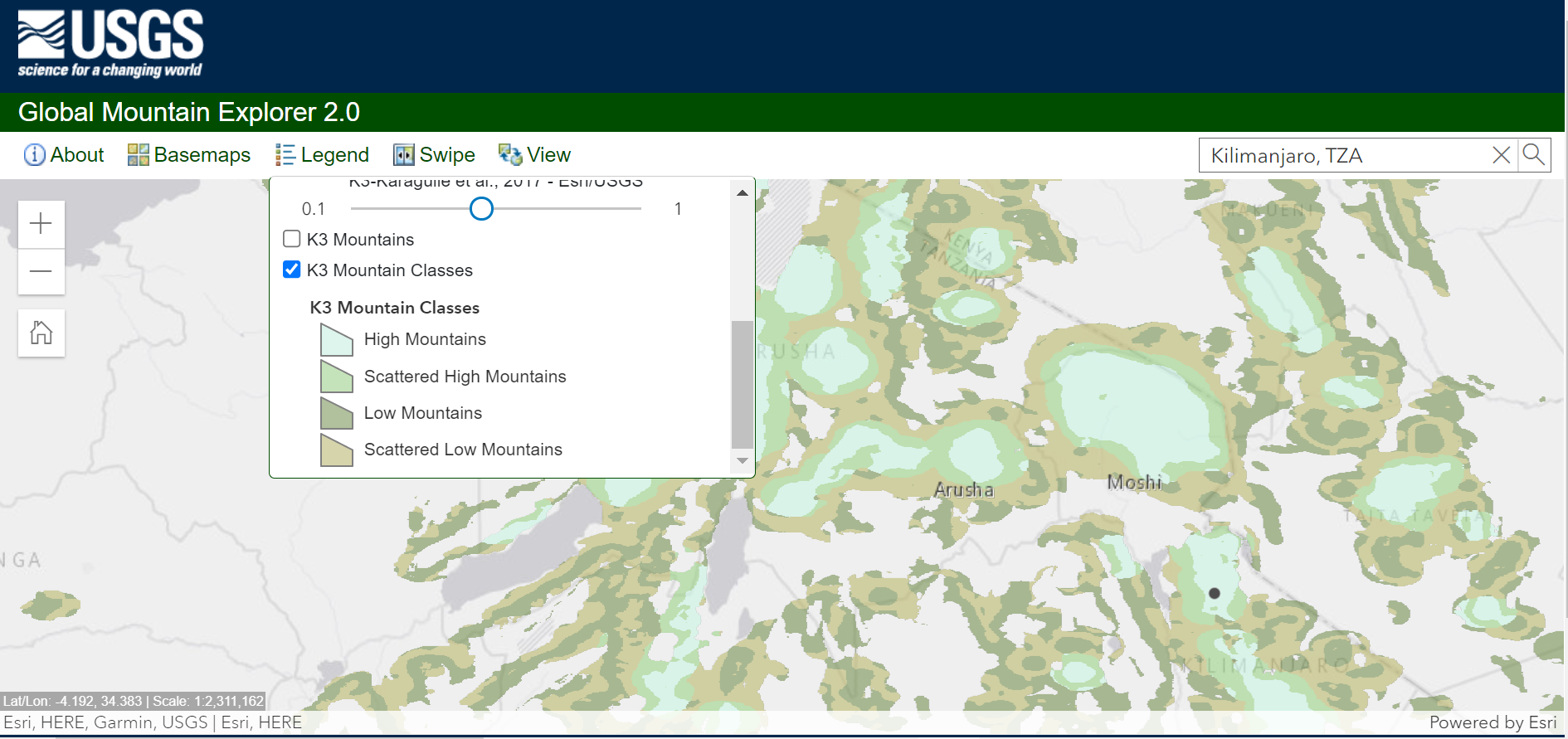
Pictured: Screen capture of the upgraded Global Mountain Explorer tool.
The GME was developed by the U.S. Geological Survey (USGS), in partnership with Esri, the Center for Development and Environment of the University of Bern (CDE), the Global Mountain Biodiversity Assessment (GMBA), and the Mountain Research Initiative (MRI). This work was part of GEO Mountains workplan to delineate and compare global mountain extent using data from three established approaches.
Download the layers
Until early 2025, the layers shown in GME we available to download directly. However, due to changes at the USGS, this is no longer the case. As a work around, we encourage interested users to instead download them from Supplementary Information: Human populations in the world's mountains: spatio-temporal patterns and potential controls (the mountain delineations were used as input data in that study).
The layers are located in the following sub-directory: Input_datasets/mountain_delineations
This text was provided by Roger Sayre, U.S. Geological Survey.