This project digitised and processed a unique archive of historical airborne stereo images to reconstruct past glacier elevations across the Chilean Andes. By creating new open-source workflows and recovering more than 4,500 photographs from the 1940s onward, the team is generated long-term glacier change records and strengthened international collaboration on historical imagery analysis.
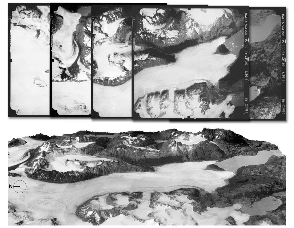
Glaciers in the Chilean Andes – particularly in Patagonia – are rapidly losing mass, yet long-term records of their evolution remain scarce. While satellite imagery has enabled monitoring since the early 2000s, understanding glacier changes over the past century requires unlocking historical datasets that remain largely inaccessible. This project set out to rescue, digitise, and process a unique collection of historical airborne stereo images, including a major 1945 Trimetrogon mission flown by the U.S. Air Force, to reconstruct early Digital Elevation Models (DEMs) and quantify multi-decadal glacier elevation change.
The team reached agreements with the National Collection of Aerial Photography (NCAP) and U.S. National Archives and Records Administration (NARA) and ultimately digitised around 4,500 aerial photographs – far exceeding the original target. Additional historical images from the 1980s and 1990s were acquired through collaboration with Servicio Aerofotogramétrico de la Fuerza Aérea de Chile (SAF). The project also developed a fully open-source photogrammetric processing pipeline for generating DEMs from these archives. Preliminary DEMs and elevation change estimates were produced for selected glaciers, including Gran Campo Nevado and Grey Glacier. Capacity building formed a central part of the project, including co-organising an international workshop in Grenoble as part of the “HISTORY” intercomparison initiative.
Key Activities & Outputs
- Digitisation of ~4,500 historical aerial photographs, creating an unprecedented archive for future glacier change analyses across Patagonia.
- Development of an open-source DEM generation pipeline and production of preliminary glacier elevation change datasets for selected test sites.
- Organisation and delivery of a specialist workshop on historical image processing, contributing to knowledge exchange and early-career training.
- Presentation of early findings at major scientific conferences (EGU 2025, DreiLändertagung 2025, Chilean Cryosphere Society Congress 2025).
- Planned peer-reviewed publications on the processing methodology (late 2025) and 80-year elevation changes at Gran Campo Nevado (summer 2026).
- Foundations laid for a future public database of DEMs and orthoimages, as well as a broader international initiative to expand historical data rescue beyond Chile.
Contact
Livia Piermattei, University of Zurich: livia.piermattei [at] geo.uzh.ch
Supported by GEO Mountains under the Swiss Agency for Development and Cooperation (SDC), Adaptation at Altitude Programme (Project Number: 7F-10208.02.01).