

Researchers from four Central Asian countries have completed a hands-on training programme in UAV-based cryosphere monitoring in Kazakhstan’s Northern Tian Shan. Supported through the GEO Mountains Small Grants Programme 2026-2027, the initiative marks an important first step towards generating openly accessible, high-resolution topographic data to support glacier monitoring, water-resource research, and hazard assessment across the region.
From 24-28 August 2026, nine researchers and technical specialists from Kazakhstan, Kyrgyzstan, Tajikistan, and Uzbekistan came together in the Ulken Almaty basin, Kazakhstan, for an intensive five-day training programme connecting high-altitude field surveying with the production of open, high-resolution geospatial data.
The training was organised by the Central Asian Regional Glaciological Centre (CARGC), under the auspices of UNESCO, as part of the project Open High-Resolution Mountain Cryosphere Topography for Water Security in Central Asia, led by Principal Investigator Zarina Saidaliyeva.
Selected for funding through the GEO Mountains Small Grants Programme 2026-2027, the project is one of eight initiatives across Africa, Asia, and the Americas working to address critical gaps in mountain observations and data availability. By combining new topographic surveys with practical training and open-data publication, the project aims to strengthen both the information and regional expertise needed to monitor Central Asia’s rapidly changing mountain cryosphere.
Addressing Critical Data Gaps in Central Asia’s Mountains
Central Asia’s mountain cryosphere is changing rapidly. Glaciers, rock glaciers, debris-covered ice, and moraine complexes store and release water, influence downstream flows and shape high-mountain hazards. Yet many of these features remain difficult to monitor with conventional field techniques alone, while the very high-resolution topographic data needed to understand their changes remain scarce.
This GEO Mountains-funded project seeks to help close this observation gap by using uncrewed aerial vehicles (UAVs) to generate detailed digital elevation models and orthophotos of selected glacier and moraine systems in the Kishi Almaty, Ulken Almaty, and Talgar river basins of the Northern Tian Shan.
UAV surveys can capture detailed, repeatable images of complex mountain terrain. When combined with accurate ground positioning and careful photogrammetric processing, these images can be transformed into orthophotos and digital elevation models that reveal surface changes at very fine scales.
Alongside these new datasets, a central objective is to build regional capacity in UAV surveying, data processing, quality assurance, and open-data publication, enabling researchers and technical specialists to continue monitoring the cryosphere into the future.
The August training represented an important early step towards these goals, bringing together participants with different institutional and technical backgrounds to learn practical methods and exchange experiences of common monitoring challenges across the region.
Surveying Rock Glaciers and Glacier Terrain
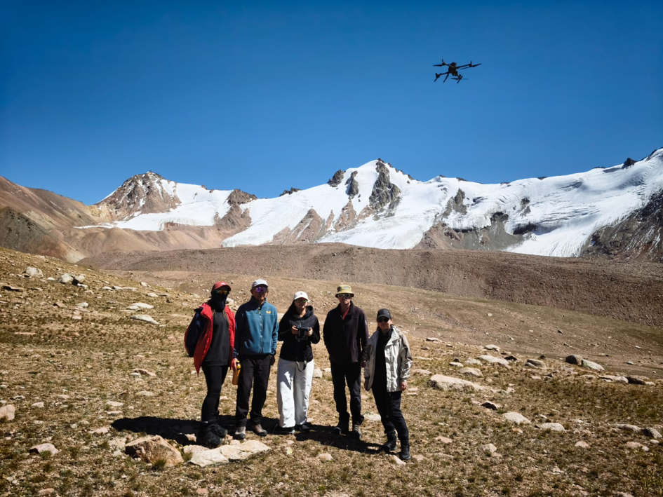
The Ulken Almaty basin served as an outdoor classroom, providing participants with hands-on experience of surveying rugged mountain terrain. Field exercises focused on the Gorodeckiy, Morennyi, and Timofeev rock glaciers, together with a glacier tongue within the basin. These landforms provided contrasting surfaces and slopes on which to explore the practical challenges of mapping debris-covered and ice-rich terrain.
Participants worked through the steps needed to conduct UAV surveys in high-mountain environments, including selecting suitable take-off locations, considering topography and flight safety, defining survey coverage, checking equipment, and coordinating field roles. They also examined how factors such as image overlap, visibility, access, and flight height affect survey quality.
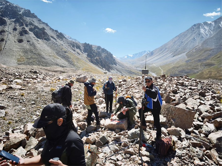
A central lesson was that high-quality mapping depends on more than the flight itself. Participants practised establishing and measuring ground control points, recording field information, and checking observations while still on site. These steps are essential for positioning the final products accurately and enabling comparisons between surveys through time.
Together, the exercises demonstrated that field planning, UAV data acquisition, ground control, and documentation form one connected workflow. Decisions made in the mountains directly affect the accuracy, reproducibility, and long-term value of the resulting datasets.
From Raw Imagery to Geospatial Data
Following the field exercises, indoor practical sessions introduced participants to the processing techniques needed to turn UAV imagery into usable geospatial products.
Participants reviewed how UAV images are organised and checked, how image alignment and photogrammetric reconstruction are performed, and how point clouds, orthophoto mosaics, and digital elevation models are generated.
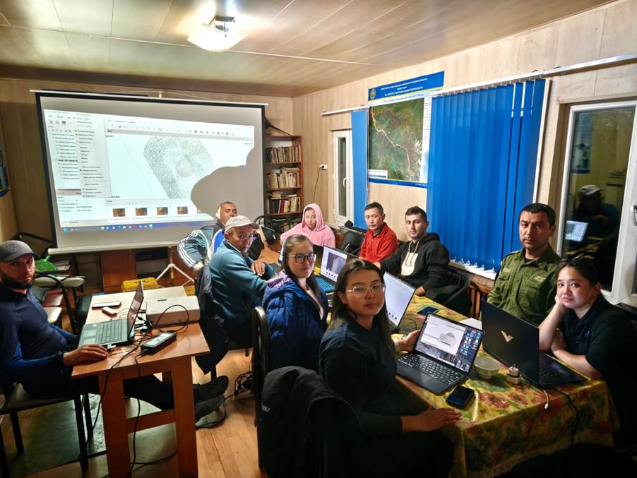
Particular attention was given to quality assurance. Image coverage, gaps, ground control, spatial accuracy, and processing reports all need to be evaluated before a dataset can reliably support change detection or scientific interpretation.
Working through these stages helped participants understand both the possibilities and limitations of UAV-derived products, while reinforcing the importance of consistent methods and careful documentation.
Preparing Data for Wider Use
Beyond the technical aspects of surveying and processing, the training also introduced the principles needed to transform locally stored project data into reusable, openly accessible geospatial resources.
Clear metadata, consistent file structures, documented processing settings, and transparent accuracy information are essential to ensuring that other researchers and agencies can understand, compare, and build upon the data.
This open-data perspective is particularly important in Central Asia, where comparable high-resolution mountain datasets remain scarce. Shared methods and accessible products can strengthen glacier monitoring, hazard assessment, water-resource research, and regional collaboration.
Building a Central Asian Community of Practice
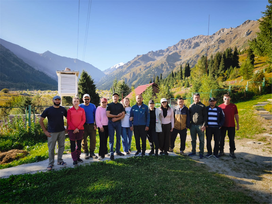
An equally important outcome of the training was the opportunity to strengthen connections among researchers and technical specialists working across Central Asia. The training was delivered by CARGC staff members Vassiliy Kapitsa, Nikolay Kassatkin, Foteh Rahimov, and Irina Dikikh, who guided the international cohort through the field and post-processing workflow while encouraging exchanges on shared regional monitoring challenges.
By bringing together technical training, practical field experience and regional knowledge exchange, the programme contributed to a shared foundation for future cryosphere monitoring activities.
Next Steps: Towards an Open Mountain Cryosphere Dataset
Following the training, the project team will continue processing, validating and documenting the UAV surveys. The wider GEO Mountains-funded project aims to produce ultra-high-resolution digital elevation models, with resolutions of up to 10 cm where conditions allow, and orthophoto plans for benchmark glacier, rock-glacier and moraine systems.
These results will contribute to an openly accessible mountain dataset and a transferable UAV-to-DEM workflow covering field deployment, photogrammetric processing, quality control, metadata, and data publication. Beyond the immediate scientific outputs, the project aims to establish the technical expertise and shared methods needed to support continued cryosphere monitoring across Central Asia.
As one of eight projects supported through the GEO Mountains Small Grants Programme 2026-2027, this initiative demonstrates how targeted funding can help address critical mountain data gaps while strengthening regional research capacity. The August training marks an encouraging first step towards more accessible cryosphere observations and improved understanding of the changes affecting Central Asia’s mountain environments and downstream water resources.