

Eight projects spanning mountain regions across Africa, Asia, and the Americas have been selected for support through the GEO Mountains Small Grants Programme 2026–2027. From rescuing historical climate observations to monitoring changing Afroalpine vegetation, the projects will help close critical mountain data gaps while strengthening collaboration and research capacity.
Mountain regions are changing rapidly, but the observations and data needed to understand those changes remain unevenly distributed. In many places, valuable historical records have yet to be digitised; monitoring networks are fragmented or sparse; and existing datasets can be difficult to find, compare, or use.
The GEO Mountains Small Grants Programme supports targeted projects that tackle these challenges, helping researchers and practitioners generate, rescue, harmonise, analyse, and share mountain data.
Following the 2026-2027 call, eight projects have been selected for funding. Together, they span a remarkable range of mountain environments and research questions, from glaciers and water resources in Central Asia and the Caucasus to climate records in the tropical Andes and biodiversity change in the mountains of Uganda.
The 2026–2027 Small Grants Recipients
1. Bringing Rescued Mountain Climate Data Into the Digital Age in Kenya
Automating the Collection and Transmission of Rescued Mountain Climate Data through Climsoft Web
Principal Investigator: Joyce Kimutai, Kenya Meteorological Department
Building on previous efforts to rescue and digitise historical mountain climate records, this project will tackle another challenge: getting observations from remote stations into operational climate systems quickly and reliably. Working around Mount Kenya and the Cherangany Hills, the team will deploy Climsoft Web so that volunteer observers can enter meteorological observations digitally, including in areas with limited connectivity, rather than relying on paper records being physically sent for digitisation. The project aims to reduce delays and errors while improving the completeness and accessibility of mountain climate data for forecasting, early warning, water management, and climate adaptation.
2. Opening a High-Resolution Window Onto Central Asia’s Changing Cryosphere
Open High-Resolution Mountain Cryosphere Topography for Water Security in Central Asia
Principal Investigator: Zarina Saidaliyeva, Central Asian Regional Glaciological Centre under the auspices of UNESCO
In the Northern Tian Shan, rapidly changing glaciers have major implications for downstream water resources and hazards, yet very high-resolution topographic data remain scarce. This project will use UAV surveys to generate and openly publish digital elevation models and orthophotos at resolutions of up to 10 cm for selected glacier and moraine systems in the Kishi Almaty, Ulken Almaty, and Talgar river basins. Alongside the new datasets, the project will train early-career researchers and technical specialists in UAV surveying, data processing, quality assurance, and open-data publication, building regional capacity to continue monitoring the cryosphere into the future.
3. Connecting the Pieces of Mountain Monitoring in Southern Chile
Collaborative Climate and Socioecological Monitoring Network in the Southern Andes of Chile
Principal Investigator: Carla Marchant, Universidad Austral de Chile
The Southern Hemisphere remains underrepresented in global mountain observation systems, even where valuable long-term observations already exist. Rather than creating another monitoring system from scratch, this project will bring existing platforms together. Climate, hydrological, soil, forest, and wildlife monitoring from three research and conservation areas in the Southern Andes of Chile will be inventoried, standardised, harmonised, and integrated into the Atlas de los Andes del Sur. The pilot phase operationalizes a scalable integration model that enhances data discoverability, supports coordinated mountain observation, and provides actionable scientific evidence for protected area management, watershed governance, and climate adaptation planning.
4. Recovering Ecuador’s Mountain Climate History
Ecuadorian Mountain Climate Data Rescue: Recovering Historical Meteorological Records from Andean Communities Near Glacierized Volcanoes and Mountain Forest Transition Zones
Principal Investigator: Luis Felipe Gualco Centeno, Escuela Politécnica Nacional
Some of Ecuador’s mountain climate history is scattered through expedition diaries, early meteorological yearbooks, institutional archives, and fragmented station records. This project will bring those observations back into use by rescuing, digitising, quality controlling, and homogenising historical temperature and precipitation records from communities around glacierised volcanoes and mountain forest transition zones. The team will also use modern gridded climate products to help reconstruct gaps in the observational record and install two low-cost automatic weather stations. The resulting open datasets and reproducible workflows will support research into glacier change, water resources, and climate adaptation in the tropical Andes.
5. Linking Mountains, Cities, Climate and Health in East Africa
Strengthening the Scientific Capacity to Advise Climate, Environmental, and Health Policy in East Africa Based on Long-Term Observations, with an Initial Focus on Kenya
Principal Investigator: Syprose Nyadida, Kenya Meteorological Department
Climate, atmospheric composition, air quality, and human health are closely connected, but the observational infrastructure needed to study those connections remains fragmented across much of Sub-Saharan Africa. Centred initially on Kenya, this project will establish a community of practice connecting researchers, practitioners, and policymakers. A science-policy symposium, training activities, and a visit to the Mount Kenya monitoring station will underpin the development of an open demonstration dataset, an inventory of existing data and gaps, a policy brief, and a 12-month academic engagement roadmap designed to strengthen the use of long-term observations in research and decision-making.
6. Following Water Through the Mountains of Georgia
Mountains, Water and Isotopes: Advancing Hydrological Understanding in the Mountains of Georgia
Principal Investigator: George Melikadze, M. Nodia Institute of Geophysics, Ivane Javakhishvili Tbilisi State University
Where does mountain water come from, how does it move through a catchment, and how might its availability change as the climate warms? In Georgia’s Greater Caucasus, this project will combine rescued historical observations with new monitoring of stable isotopes in precipitation and streamflow to support investigations into those questions. The team will establish new observations along the Aragvi-Kazbek elevation gradient, including a new streamflow gauge, and develop an isotope-enabled water balance model for the Aragvi catchment. The resulting datasets and modelling will strengthen understanding of current and future water availability in a region where high-mountain observations remain limited.
7. Making Glacier Hydrology More Comparable Across Mountain Regions
Harmonizing Forcing Data to Improve Comparability in Glacierized Mountain Hydrology
Principal Investigator: Caroline Aubry-Wake, University of Lethbridge
Glacio-hydrological models help researchers understand snow accumulation, glacier melt, and runoff, but comparing results between mountain regions can be difficult when modelling studies rely on different meteorological inputs. This project will address that problem across four glacierised catchments in the Canadian Rockies, European Alps, Andes, and Hindu Kush Himalaya. By harmonising observational and reanalysis datasets and running comparable model experiments, the project will create open datasets, reproducible workflows, and a cross-basin benchmark showing how different meteorological inputs affect modelled snow, glacier melt, and runoff. The work is led by an early-career researcher and will also directly support student training.
8. Returning to Africa’s High-Mountain Summits, 15 Years Later
Resurveys of Tropical African GLORIA Sites for a Global Comparison
Principal Investigator: Fredrick Ssali, Uganda Martyrs University
In 2011, researchers established Africa’s first GLORIA monitoring sites in Uganda’s Rwenzori Mountains and Mount Elgon. Fifteen years later, this project will return to the same permanent plots to investigate how their distinctive Afroalpine vegetation has changed. Researchers will record plant species composition and abundance, examine vegetation traits, and retrieve soil-temperature records, allowing changes between 2011 and 2026 to be assessed. Crucially, the resurveys will enable these two African sites to contribute to a wider global synthesis of high-mountain biodiversity under climate change, while training local early-career researchers and conservation managers in long-term vegetation monitoring.
Small Grants, Lasting Value
Although modest in scale, the GEO Mountains Small Grants are designed to unlock work that can have value well beyond the lifetime of an individual project.
The REACH project, supported through the 2024–2025 programme, offers one example. A multinational team developed the most up-to-date and detailed regional hydropower dataset for High Mountain Asia, covering 1,811 existing and planned hydropower projects, and used it to investigate exposure to cascading rock and ice avalanche hazards. The project also supported new regional collaborations and represented an important professional milestone for its Principal Investigator, Yan Zhong, who led a project as PI for the first time.
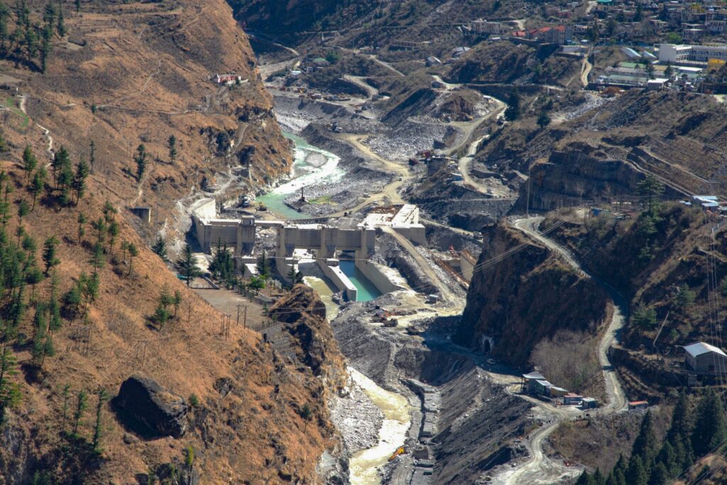
Other projects from the previous funding round have used Small Grant support to expand high-elevation observations on Kilimanjaro, rescue historical imagery of glacier change in the Chilean Andes, and shed light on a hidden climate risk in Peru.
These examples point to the wider purpose of the programme, which is not simply to generate more mountain data, but to help make observations available, accessible, comparable, and useful, while supporting the people and collaborations needed to sustain mountain research over the longer term.
Looking Ahead
We warmly congratulate all eight successful project teams and look forward to following their work over the coming year.
We would also like to thank everyone who submitted a proposal to the 2026–2027 call, as well as the reviewers from the GEO Mountains community who contributed their time and expertise to the selection process.
Over the months ahead, GEO Mountains will share updates from the projects as they move from proposals to fieldwork, datasets, tools, training, and new collaborations, and ultimately to resources that can be used by the wider mountain research and practitioner communities.